

Drone mapping has made surveying, construction, agriculture, mining, and land management faster and more accessible. Modern drones with high-resolution cameras and RTK or PPK technology can quickly collect detailed aerial data.
But one question often comes up: Do you really need GCPs for drone mapping?
The short answer is: not always. Whether you need GCPs depends on the accuracy you need, the equipment you use, the project type, and how you'll use the final mapping data.
What Are Ground Control Points?
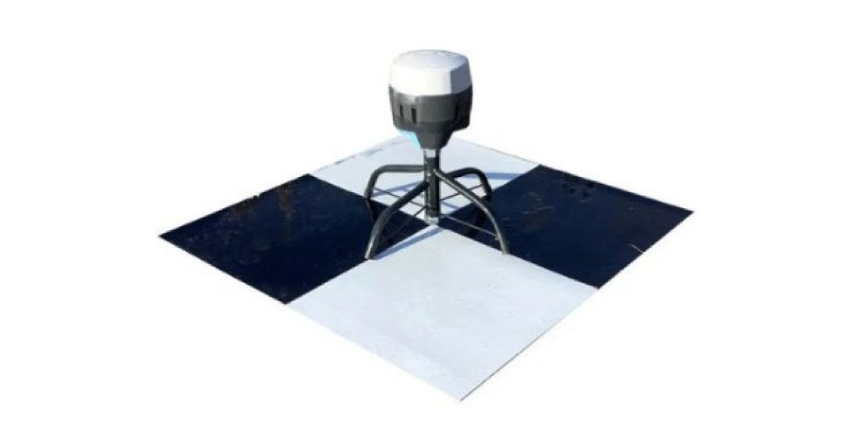
Ground control points are clearly identifiable markers placed on the ground at known geographic coordinates. Surveyors measure these coordinates using high-precision GNSS equipment and then use them during photogrammetric processing.
Mapping software matches the visible GCPs in aerial images to their surveyed coordinates. This helps correct positional errors and improves the overall accuracy of the resulting map or 3D model.
GCPs can be especially useful for:
Improving horizontal and vertical accuracy
Reducing positioning errors
Georeferencing aerial imagery
Improving digital elevation models (DEMs)
Validating the accuracy of a drone survey
When Do You Need GCPs for Drone Mapping?
For many professional surveying projects, GCPs remain an important part of the workflow. They provide independent, ground-based measurements that help tie drone imagery to a reliable coordinate system.
You should strongly consider using GCPs when:
1. High Accuracy Is Required
Projects involving engineering, construction, cadastral work, or detailed surveying may require centimetre-level accuracy. In these cases, standard GPS positioning alone may not provide sufficient accuracy.
Ground control points can help photogrammetry software adjust the aerial dataset to match accurately surveyed locations.
2. You Are Using a Standard GPS Drone
A drone without RTK or PPK typically relies on conventional GNSS positioning. Its image locations may contain several meters of positional uncertainty.
Adding surveyed control points can significantly improve the absolute accuracy of the final orthomosaic, point cloud, or elevation model.
3. Vertical Accuracy Matters
Elevation errors can affect contour maps, grading plans, drainage studies, and construction measurements.
Well-distributed control points can help improve the vertical positioning of a photogrammetric model, particularly across larger or uneven sites.
When You May Not Need GCPs
GCPs are not automatically necessary for every drone mapping project. Modern RTK and PPK drones can reduce the need for traditional ground control in many applications.
You may be able to work without GCPs when:
The drone has reliable RTK or PPK positioning.
The project does not require strict absolute accuracy.
You are creating visual maps or models rather than survey-grade deliverables.
You are working on a small, straightforward site.
You can verify accuracy using independent checkpoints.
However, removing GCPs does not mean you should ignore accuracy checks. Even highly capable positioning systems can produce errors from poor satellite visibility, correction problems, camera calibration issues, or processing problems.
GCPs vs. RTK and PPK
RTK and PPK are two technologies that can reduce dependence on traditional ground control.
RTK (Real-Time Kinematic) corrects the drone's positioning during the flight using real-time correction data. PPK (Post-Processed Kinematic) applies positioning corrections after the flight during data processing.
Both technologies can provide highly accurate camera positions. However, they do not eliminate the value of ground-based verification.
For demanding projects, combining precise drone positioning with strategically placed control or check points can provide greater confidence in the results.
Best Practices for Using GCPs
If your project requires GCPs for drone mapping, proper placement matters just as much as the number of points.
Distribute Points Across the Survey Area
Avoid placing all control points in one location. Spread them around the perimeter and throughout the site so the processing software can use them effectively.
Make Markers Easy to Identify
GCPs should contrast strongly with their surroundings and be large enough to appear clearly in aerial photographs.
Survey Coordinates Accurately
Use appropriate GNSS surveying equipment and ensure the coordinates use the correct coordinate reference system for your project.
Consider Checkpoints
Checkpoints are independent surveyed locations that are not used to control the model. Instead, they help you evaluate the actual accuracy of the finished mapping product.
So, Do You Really Need GCPs?
The answer depends on your project requirements.
For casual mapping, visual documentation, or some RTK/PPK workflows, you may not need traditional GCPs. For high-accuracy surveying, engineering, construction, and projects where reliable absolute positioning matters, ground control can still provide valuable accuracy and quality assurance.
Ultimately, view GCPs for drone mapping as an accuracy tool, not a requirement for every flight. Before skipping them, consider your required accuracy, drone positioning technology, terrain, project size, and final deliverables.
When accuracy matters, a small investment in properly surveyed control points can give you much more confidence in your drone mapping results.